Quick Facts
- Pronounced (TOKE)
- Current Population 1,278 (2012 Alaska Department of Labor Estimate)
- Legislative Districts (link to State Legislature page):
- Senate District T
- House District 39
- Judicial District 4
- Latitude: 63.3367
- Longitude: -142.9856
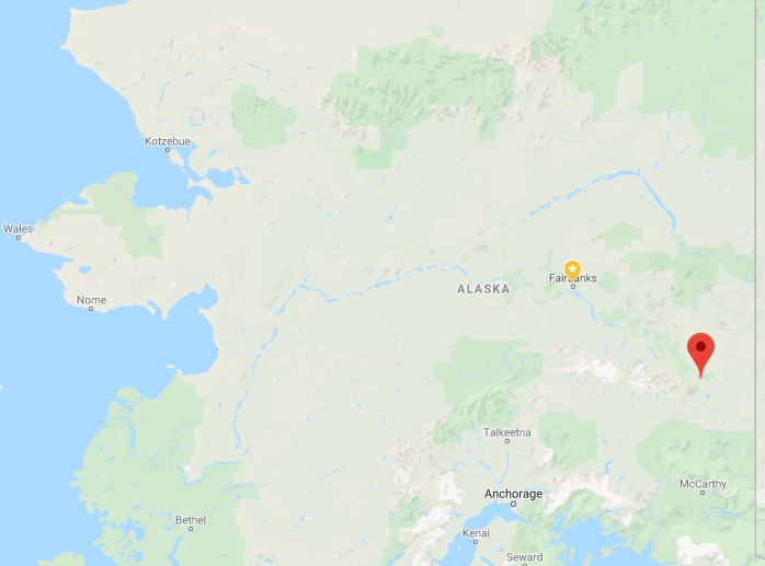
Location
Tok is located at the junction of the Alaska Highway and the Tok Cutoff to the Glenn Highway, at 1,635′ elevation, 200 miles southeast of Fairbanks. It is called the “Gateway to Alaska,” as it is the first major community upon entering Alaska, 93 miles from the Canadian border.
Climate
Tok is in the continental climate zone, with cold winters and warm summers. In the winter, ice fog and smoke conditions are common. The average low temperature during January is -32 °F; the average high during July is 72 vF. Extreme temperatures have been measured from -71 to 99 °F. Annual precipitation averages 11 inches, with 33 inches of snow.
History
It is uncertain how Tok got its name. However, the nearby “Tokai River” was first reported in 1887 by Lt. Allen. “Tok River” was recorded in 1901 by the USGS. Tok began in 1942 as an Alaska Road Commission camp. So much money was spent in the camp’s construction and maintenance that it earned the name “Million Dollar Camp” by those working on the highway. In 1944 a branch of the Northern Commercial Company was opened, and in 1946 Tok was established as a Presidential Townsite.
With the completion of the Alcan Highway in 1946, a post office and a roadhouse were built. In 1947 the first school was opened, and in 1958 a larger school was built to accommodate the many newcomers. The U.S. Customs Office was located in Tok between 1947 and 1971, when it was moved to Alcan at the border. Between 1954 and 1979, a U.S. Army fuel pipeline operated from Haines to Fairbanks, with a pump station in Tok. The pump station’s facilities were purchased as area headquarters for the Bureau of Land Management.
The U.S. Coast Guard constructed a LORAN (Long Range Aid to Navigation) station in 1976. Four 700′ towers, located 6 miles east of Tok junction, transmit radio navigation signals for air and marine traffic in the Gulf of Alaska.
In July of 1990, Tok faced extinction when a lightning-caused forest fire jumped two rivers and the Alaska Highway, putting both residents and buildings in peril. The town was evacuated and even the efforts of over a thousand firefighters could not stop the fire. At the last minute a “miracle wind” (so labeled by Tok’s residents) came up, diverting the fire just short of the first building. The fire continued to burn the remainder of the summer, eventually burning more than 100,000 acres. Evidence of the burn can be seen on both sides of the highway just east of Tok.
Culture
The area was traditionally Athabascan, although the current population is primarily non-Native. Tok has become known as the “Sled Dog Capital of Alaska.” Although residents have chosen not to incorporate as a municipality, there are numerous local volunteer committees for various community functions and various membership organizations.
Community profile data provided by the State of Alaska Department of Commerce, Community and Economic Development.