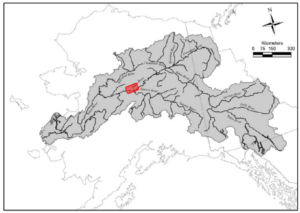
The Tanana Chiefs Conference (TCC) Tribal Resource Stewardship Department (TRS) is currently conducting a feasibility study on the Middle Yukon River that will test the applicability of using sonar to count salmon as they migrate through to their spawning grounds. Currently, the Alaska Department of Fish and Game (ADF&G) operates two similar sonar counting stations, one in the Lower Yukon at Pilot Station and one in the Upper Yukon located near Eagle. These counting stations are used to provide fisheries managers with the needed in-season information in order to direct management actions towards the fishery. TCC and its member Tribes are currently building Tribal scientific capacity by conducting the required feasibility efforts that will lead to the eventual operation of a sonar assessment project located in the Middle Yukon River. The project may eventually provide fisheries managers with information that can be used for improved in-season fisheries management actions.
Field efforts for the feasibility study started in 2023 when TRS contracted Yukon River Transport LLC to help investigate eight different locations between Galena and Rampart. Out of those eight locations, three were identified as areas of interest. During the 2024 field season two of those sites were investigated further for sonar feasibility.
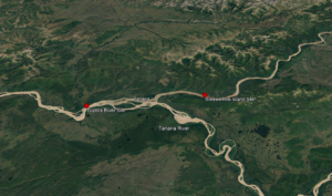
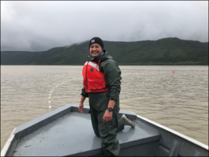
Beginning in early July of this year, TCC along with Charlie Wright (Yukon River Transport LLC) investigated two potential locations near the village of Tanana on the Yukon River. One location is above the confluence of the Tanana River near Sixteen Mile Island and the other is below the Tanana River confluence near the mouth of the Tozitna River. The crews spent seven days at each site collecting data to ensure main objectives were met.
The main objectives of the 2024 field season were to:
- Gather in depth bottom profiles near the areas of interest.
- Find the travel corridors for migrating fish.
- Test the feasibility of drift gill netting near the sonar sites.
- Determine the fish community that the project would likely encounter during sonar operations.
- Determine which sonar equipment would be necessary for next year.
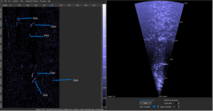
To meet objectives lined out in the study plan, sonars were installed on both the north and south banks of the Yukon River at each prospective site. For this year, the scope of the field study was not to get an absolute abundance of salmon as they migrated through. Instead biologists wanted to know which bank the salmon preferred and how far offshore they traveled. Using specialized software (see Figure 2) biologists are able to count migrating fish as they moved through the sonar beam. The sonar indicated many fish and how far offshore they traveled from the sonar. While this data is still being processed and analyzed, this information will help determine the migratory corridors of these salmon and which types of sonar will be necessary for next year’s feasibility efforts.
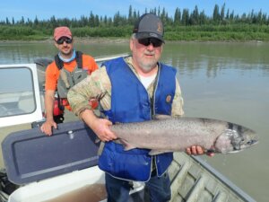
Testing the feasibility of drift gillnetting at each location was another crucial component in the sonar feasibility process. Since the sonar is not able to distinguish between fish species, using drift gillnets with various mesh sizes allows biologists to collect data on the composition of the fish community as well as the proportion of each fish species passing through the sonar beam. Drift gillnetting is not a common traditional practice where the sonar locations are being proposed. Being able to drift gillnet is essential to understanding which fish species are being detected by the sonar. Overall a total of 16 Chinook salmon, 14 chum salmon, and 9 round whitefish were caught during the testing fishing process. Due to a carefully planned protocol and respectful handling by the crew, every fish was released quickly and unharmed.
We also included an additional objective that was not part of our original study plan. Genetic samples were collected from Chinook salmon captured during test fishing at the site near the Tozitna River. The Tozitna River site is in close proximity to the confluence of the Yukon and Tanana Rivers. There is speculation and some evidence both within Indigenous and western science that suggests the Chinook salmon population is “separated” at this point in the river. This could mean that the vast majority of Chinook salmon encountered on the north bank would be of Upper Yukon River origin and the Chinook salmon encountered on the south bank would be of Tanana River origin. The goal was to gain some information on the strength of bank orientation at this location in the river. The sample size was small, but this information should give us some insight on whether bank orientation could be used as a tool for independent stock assessments between Tanana River and Upper Yukon River stocks. The results of the genetic samples could have implications for site selection and will determine whether a more in-depth study is warranted.
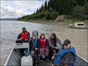
Our deployment near Sixteen Mile Island overlapped with Tanana’s Spirit Camp. Spirit Camp staff were kind enough to let TCC staff stay at their camp and included our project into their camp curriculum. As such, Spirit Camp youth participants were able to learn about using sonar to monitor salmon migrations, and they also assisted TCC staff with test fishing operations.
This year’s field season came with many successes and several challenges; however the fisheries crew was able to collect valuable data at both sites. Once the data has been analyzed an informed decision will be made on which of the two sites should be investigated further in 2025.